

Creator
Rand McNally & Company
Description
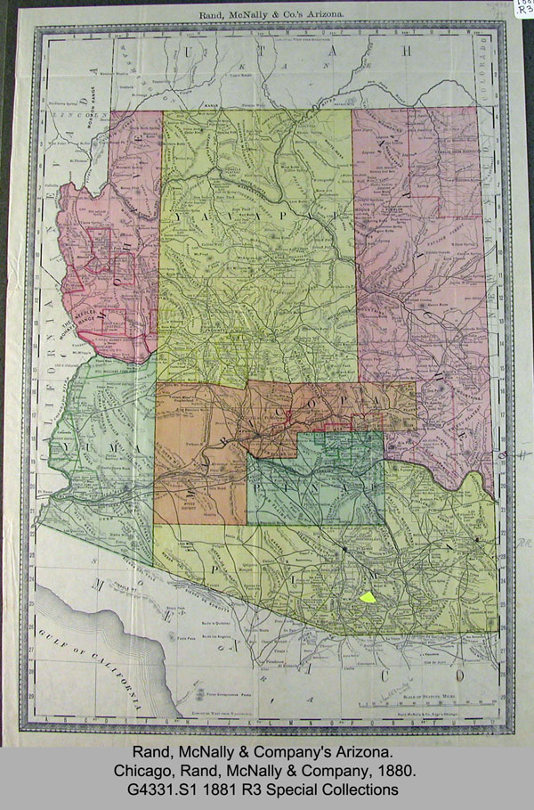
1880 color map of Arizona.
Call Number
G 4331.S1 1881.R3 Special Collections
Format
jpg
Title
1880 Rand McNally & Co.'s Arizona Map
Abstract
1880 map of Arizona shows the seven counties at the time: Mohave, Yavapai, Apache, Yuma, Maricopa, Pinal and Pima. The Empire Ranch location is shown on this map in Pima County.
Created
1880
Copyrighted
1880
Download
Keywords